Geocode Addresses (CorTexT)
Context
- This scenario provides a way to load a csv file containing a column with address information. It runs the following scripts in Cortext Manager:
- Data parsing
- Geocoding script
- It will output the result of the Geocoding script as a csv file with the longitude and latitude values for each address.
Steps
- Upon logging in, start a new project and proceed to import the "Geocode Addresses (CorTexT)" scenario. Next, configure the scenario by filling in the necessary inputs:
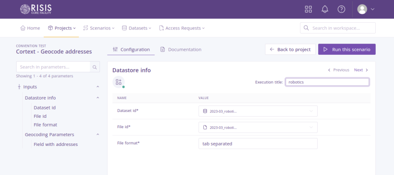

- Dataset id: Select a dataset that you have previously uploaded in this project.
- File id: Select a file from the dataset you have seleted in the previous field.
- File format: Select a file format. It could be tab separated or standard csv separated by ; and minimal quoting.
- Field with addresses: Select a field name containing addresses.
- Execution title: Enter an execution title to categorize each scenario configuration execution. This field is optional.
- When all the required fields are filled, you can click on the button in the top right ‘Run this scenario’.
- After the scenario execution is finished, check in the Outputs of the project for the new files produced.